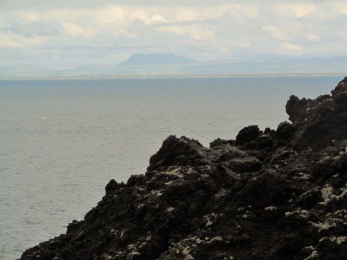
Category Archives: Travel

A Visit to the Two Famous Gaping Holes in Arizona

Gaping Hole #1.

The stars lined up just right to attend an open house at the Very Large Array (VLA) near Magdalena, New Mexico, on October 11, 2025. But first, a diversion to Arizona from Albuquerque, NM.  Our first stop was the Barringer Meteor Crater near Winslow, AZ. This gaping hole in the ground is maybe the best example of an impact crater anywhere. If you happen to be driving along on Interstate 40 in Arizona, is it worth the 5 1/2 mile diversion and the admission price? I’d say yes, but is it worth visiting after a long drive from Chicago for a single destination? I don’t know. Your call.

Out of order sign at the Meteor Crater. Photo by Arnold Ziffel.

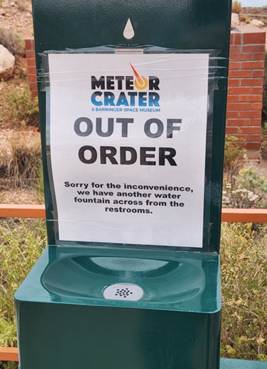
At first glance the sign seems to say that the Meteor Crater is out of order.

Without a wide angle lense this is the widest shot we could get from the walkway. Photo by Arnold Ziffel.

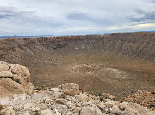
Too small to see clearly are the remains of mining operations at the center of the crater. Mining engineer Daniel M. Barringer dug a 200 ft deep mineshaft looking for remains of the meteor believing that it should be rich in iron. Not much was found. The boiler and steam powered winch remain in place, rusting away. Barringer received a land patent for 640 acres centered on the crater. The crater remains in private hands to this day.

Gaping Hole #2.

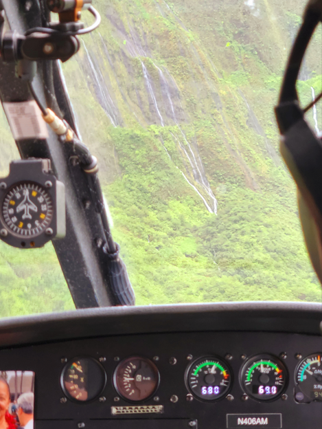
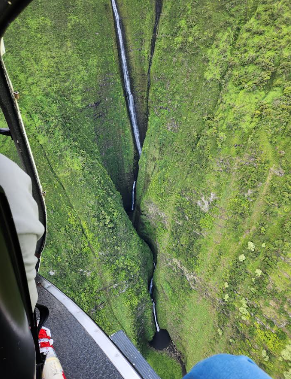
Gaping hole #2 would be the Grand Canyon. it was my first visit. We enjoyed a helicopter tour over this famous canyon. We rode in an Airbus H130 and were treated to a smooth ride. The pilot played the song Danger Zone from the movie Top Gun as we lifted off. It was a little corny, but who cares. Helicopter rides are always spendy, but often worth it as this one was.

Is there anything new for me to say about the Grand Canyon? Ah, nope.

After the fog lifted out of the canyon, this appeared. Photo by Arnold Ziffel.

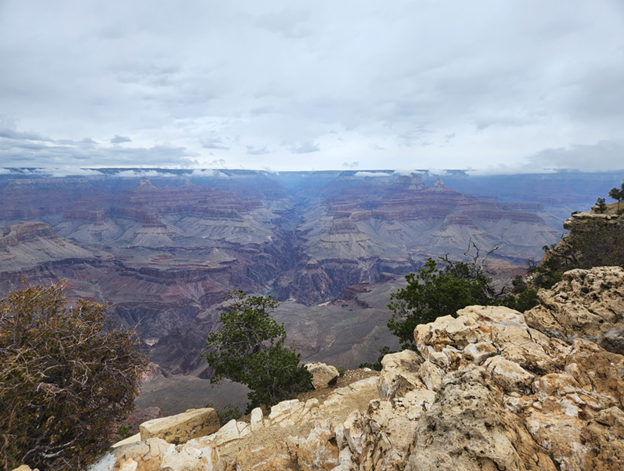
The stratigraphy of the canyon is fascinating. The Grand Canyon has been eroded out of the Colorado Plateau by the Colorado River over geological time. As the plateau lifted upwards, the river cut downwards. The many buttes and ridges in the canyon remain to show the fickle nature of erosion. Meteoric water and gravity cut through the canyon walls from the rim all the way down to the present course of the river- a mile deep in some places. The basement rock of granite is even exposed in some locations. It is striking how the many layers of sedimentary rock have stacked from such great depths. Deep geological time is impossible to comprehend. Each layer was put in place in a way that driven by the climate and location of surface of the earth at a particular time. Many variations of sandstone, limestone and dolomite are found resulting from the unique sedimentation processes of the time.

Island Hopping

We returned from Hawai’i two weeks ago after 4 nights on Maui and 4 nights on Hawai’i Island (the Big Island). I’ve been trying to summon words to describe the visit, but I keep coming up short. I can certainly see the appeal.

Sunset from atop Mauna Kea, 13,800 ft. Three of the 13 observatories there are visible on the right. What doesn’t come through is howling and freezing wind. Very cold. Photo by Arnold Ziffel.

Above is a sunset photo from (almost) atop Mauna Kea on the big island. Our guide said the whole island can be thought of Mauna Loa with numerous volcanoes along the slopes. One of them is Mauna Kea and another is Kilauea and Hualalai Volcano. Many smaller cinder cones dot the slopes of Mauna Loa. Much of the island is covered with jet-black lava flows

We took an open-door helicopter tour from the Kahului airport in Maui to the coast of Molokai and back. The doors were removed and 6 of us wedged into the helicopter. It was the most exhilarating ride in an aircraft I’ve ever taken. We flew along the northeast coastline of Maui pausing to follow the canyons to the end and watching in wonder the rainforest below clinging to the extremely steep canyon walls. Waterfalls are everywhere. In the photo below, we followed a stream up a canyon on Maui and saw a waterfall coming straight out of the mountainside. I hadn’t realized that the lava formations could be so porous. As you drive by the a’a lava flows you can see how the irregular piling of lumpy and jagged lava flows when stacked vertically could be porous.

Pilot’s eye view of streams coming out of the rock walls and forming these waterfalls on Maui. Photo by Arnold Ziffel.

The photo below shows a very narrow gorge and waterfall on the extremely steep cliffs along the shore of Molokai. It’s hard to know if the narrowness and depth of the gorge is due to rapid stream erosion or is an artifact of how the lava flows piled up. Several of the locations on both Maui and Molokai have some of the highest annual rainfall on earth. These rainy mountainous areas have been called ‘vertical bogs’.

East coast of Molokai with its steep cliffs next to the shoreline and an extremely narrow gorge. Photo by Fred Ziffel.

Situated near the summit of Mauna Kea are 13 astronomical observatories. One that I was unaware of is the Submillimeter Array shown below. The telescopes are placed in such a manner as to act as an interferometer. It has been used along with the adjacent James Clerk Maxwell Telescope. The Maxwell telescope is designed to observe from the far infrared to the microwave range.

Five of the eight 6-meter submillimeter radio telescopes located near the summit of Mauna Kea at 13,425 feet. Photo by Sam Drucker.

Hawai’i is full of wonder and natural beauty, and I can now understand what all of the hype is about.

Cripple Creek Gold

A Blacksmith shop is all that remains of Anaconda, Colorado.

A Blacksmith shop is all that remains of Anaconda, Colorado.

The discovery of gold in the early 1890’s west of Pikes Peak at Cripple Creek was the last major gold rush in Colorado. This discovery coincided with the repeal of the Sherman Silver Act which compelled the government to guarantee a price for silver. The repeal of the Sherman Silver Act led to an immediate collapse in silver prices and the crash of virtually all silver mining operations.  As a result, miners in the area made their way to Cripple Creek for newly discovered gold.

Today many of the valleys around Cripple Creek and Victor are largely regrown and quiet. Little indication remains of the towns and mills that once covered the area. Many mining towns were consumed by fire and a few were rebuilt. Once town left to extinction is Anaconda.

In the winter of 1904 a fire consumed the mining town of Anaconda. Today, all that remains is the shell of a blacksmith shop. This abandoned building sits at the end of the line on the Cripple Creek and Victor Narrow Gauge Railroad (CC&V).  Near Anaconda were a number of significant mines- the Mary McKinney, the Doctor Jack Pot, the Chickenhawk, the Anaconda mine and others.

Nearby is the Mollie Kathleen mine which is open for tours. This tour involves piling into a small-man lift and dropping 1000 ft into the mine. This puts you below the level of Cripple Creek, located in the valley below. If you are very lucky, the big open pit gold mine on the other side of the mountain will do some bench blasting while you are down there. It’s very exciting. The mountain between the big CC&V mine and the Mollie Kathleen is riddled with shafts and drifts.

The Cripple Creek & Victor Gold Mine east of Cripple Creek is a large open pit gold mining operation run by Newmont Mining Corporation. The gold in the mine is highly disseminated in microscopic form and is recovered by cyanide heap extraction. The CC&V deposit is the remnant of an extinct volcano that is highly brecciated. Hydrothermal water has extracted and transported gold throughout the throat of the volcano and into the surrounding rock. However, much of the gold (ca 30 %) is tied up as gold telluride, AuTe2, also known as calaverite. The gold in calaverite cannot be extracted with cyanide and must be left behind. The tellurium can be removed by roasting and burning off the oxide, but this is highly polluting. This gold formation is where the famous Cresson Vug was located. It was a cavity in the formation that yielded 60,000 troy ounces of gold.

CC&V Steam Engine

CC&V Steam Engine

The CC&V railroad is a modest tourist attraction located on the outskirts of Cripple Creek. The line has several operating steam locomotives that take passengers on a 45 minute trip into the countryside. Our engineer estimated the horsepower of the engine above to be ca 20 hp.  Narrow gauge rail was popular in mountainous areas as opposed to standard gauge owing to the ability to negotiate a tighter turn radius.

Hello Iceland

We’re back from a refreshing June visit to Iceland. I can recommend a visit to this gentle country to anyone and without reservation. If you’ve traveled in other parts of Europe, there will be no surprises; if not, the cultural shock will be minimal. Driving the paved roads is a breeze, traffic control minimal, everyone speaks English and credit cards are accepted nearly everywhere.  The unit of currency is the Icelandic Krona or ISK. As of today the exchange rate is 122.85 ISK to the dollar. Gasoline was in the neighborhood of 208 ISK per liter, so gas seems a bit spendy to an American. I would compare the prices one will encounter as a tourist to be in the range of a visit to NYC or Boston.

Flight arrival happens at the town of Keflavik (KEF) southwest of Reykjavik. Reykjavik is a half hour drive north from the airport. The famed Blue Lagoon (Bláa lónið) spa is a short drive south from Keflavik. Be warned, reservations are required and the earlier the better. Our experience was that they would not allow walk-in visitors to gain or even schedule entry. Online registry is done exclusively. This spa is an artificial body of geothermal hot spring water that has its source from the adjacent geothermal plant Svartsengi.

Iceland is a country with 330,000 inhabitants, 200,000 of which live in Reykjavik. The population density is low. It is like taking Boulder county, Colorado, and plopping the population onto an area the size of Kentucky. We saw none of the garish tourism blight in the form of signage and souvenir shops so ordinary in the US. While folks back home were sweltering in the heat we enjoyed the benefits of North Atlantic climate, namely 55 °F temperatures and drizzle.

The only bit of unpleasantness for us was getting through US customs in Minneapolis-St. Paul (MSP) on the return trip. We arrived at MSP within a day of an explosion at an airport in Turkey. Consequently the TSA sphincter had already slammed shut at American customs and passport control entry points and security theatre had gone full Hollywood.

From Denver the total flight time on Delta to Keflavik was about 8 1/2 hours. We arrived on the summer solstice so for our 8 days in country there was effectively no darkness, just a few hours of twilight.

Our experience with accommodations was positive. Most nights we stayed in a guesthouse. These are essentially a B&B arrangement, but the proprietors were not resident in the same building as may be the case in other countries. Breakfast is optional so be sure to select it when booking a room. I used Booking.com and had not a speck of trouble with it. However, once in country I did notice that the guesthouse options were much more extensive than what appeared on the Booking.com website.

There are several ways to explore Iceland. There are numerous day tours available from Keflavik and Reykjavik as well as more extensive guided bus tours. A colleague took a 12 day self-driving tour through an agency called Nordic Visitor. They drove themselves from point to point around the Island on the ring road. Nordic Visitor pre-arranged for accommodations and excursions like glacier hikes, etc., along the route.

Center, The island of Surtsey in the Westman Islands, Iceland.

Center, the island of Surtsey, newest of the Westman Islands, Iceland.

We took a chance and planned our own tour with a rental car. Not knowing the scale and drive times between places of interest was problematic. Highway speed was 90 kph at it’s greatest and often 40 to 70 kph in many locations. In town the speed was usually 30 kph. I took a conservative approach and stayed within what turned out to be about 7 hours from Reykjavik. Really, this was too conservative and prevented exploring the eastern side of the island. On the positive side, this approach prevented us from spending all of our time driving.

Iceland is a geologist’s paradise. It arose from the divergent drift of the Eurasian and North American plates at the mid-Atlantic ridge – a global feature that dominates its geology today. The island has many active volcanoes as well as glaciers. Many of the volcanoes are actually under a glacier. When they erupt there may be large floods as the ice melts from the volcanic heat.

Heckla as viewed from the island of Heimaey 6-16

Hekla as viewed from the island of Heimaey 6-16

The volcano Hekla near the south coast of Iceland is part of 30 volcano systems on the island.  The picture above was taken from the island of Heimaey in the Westman Islands. These islands make up this volcanic archipelago. Incidentally, nervousness about the state of Hekla lead our car rental agency (Budget) to offer volcanic ash insurance to it’s customers.  I’ll admit- I bought it.

Daytripping in the Gold Hill and Wall Street Mining Areas

The Gold Hill mining district northwest of Boulder, Colorado, is dotted with many signs of mining activity from an earlier time. This district is adjacent to the towns of Ward and Nederland and situated in the northeastern extreme of the Colorado Mineral Belt (CMB).  The first significant gold lode discovery of the 1859 Colorado Gold Rush occurred in this area. Gold Hill is at the northern end of a particularly rich band of gold lode occurrences within the CMB stretching southward in parallel with the Front Range through Central City, Idaho Springs, and further south to Cripple Creek.

The town of Gold Hill (actually a CDP) is connected to Left Hand Canyon road via Lick Skillet road, reportedly the steepest maintained county road in the USA. I can verify the steepness of this gravel road and would heartily suggest shifting into first gear while driving down this mile-long toboggan run.

While mining has long since halted at the great majority of mines in this district, the Cash Mine east of town is still in operation.

To the south of Gold Hill is a CDP settlement called Wall Street. This was the location of a mine and a mill. Or they called it a mill. It should probably be called a smelter since roasting was used in the process.

No, it’s not a Babylonian fortress. It is part of the Wall Street Mill in Wall Street, Colorado. Copyright 2010 Th’ Gaussling.

The Wall Street Mill today sits on private property and access is not available to the motoring public. The site sits along the road on Four Mile Canyon Drive, a mile from the intersection with Gold Run Road and south of Gold Hill.

The imposing structure along the road is actually a cooling bin for the storage of freshly roasted ore.  A sign posted along the road says that the mill process used roasting, chlorination, and cyanidation to recover the gold values. The sign also indicates that the mine closed after only a few years of operation due to poor management. Poor operating practices were not uncommon.

Roasting was a common step in the metallurgy of sulfur-rich gold and silver ore. The purpose of roasting is to change the chemical composition of the ore by oxidation of metal sulfides to produce metal oxides. The gold and / or silver in the ore was difficult to isolate without this process. The matrix of metal sulfides in the ore interfered with the extraction of distributed and native gold by amalgamation. And without chemical processing, silver was all but impossible to extract from the ore with 19th century technology.

But roasting was only a prelude to further processing. Roasted ore could be crushed in a stamp mill to produce a greater surface area for extractive metallurgy or could release particles of native gold. Reduced, native, gold could then be isolated with shaker tables to partition the dense gold particles into a slurry stream for isolation and further refinement. Alternatively, the pulverized ore could be passed over copper amalgamation tables for dissolution into mercury. A trip to the retort would distill away the mercury (mostly) and afford a button of isolated gold. Gold and silver can be extracted with mercury.

Gold that was highly distributed in microscopic particles could be extracted chemically using several options in the late 19th century.  Selectivity was always a problem and processing trains became relatively complicated in an effort to provide the purest gold and silver possible.

Roasted gold and silver ores could be subjected to chlorination (or chloridation) processes that produced chemically extractable gold or silver. Roasting ore with sodium chloride in a reverberatory furnace, for instance was commonly done to produce gold and silver chlorides that were accessable via aqueous extraction methods. The origin of metallurgical chlorination  traces back to von Patera in the Bohemian silver mining town of Joachimsthal.

Chlorination by generation of Cl2(g) was not uncommon. Wetted ore was exposed to freshly generated chlorine, producing metal chlorides in the roasted ore pulp. A process similar to the method of Scheele in 1774 (MnO2 + 4 HCl-> MnCl2 + 2 H2O + Cl2) was used to generate the chlorine on the spot for chlorination. Manganese dioxide, sometimes referred to as the peroxide of manganese, was treated with sodium chloride and sulfuric acid. Gold chloride could be extracted by water and then reduced to gold powder with zinc, iron scrap, or green vitriol (iron (II) sulfate, a 1-electron reducing agent).

Cyanidation was also used according to the information at the site. I’ll leave this method for another post.

Wall Street Assay Office Copyright 2010 Th’ Gaussling

An assay office sits adjacent the mill. The upper level of the assay office served as a residence and pool hall. At its peak, this site was home to 300 people. The Assay Office is now maintained by Boulder County.

Summer Kitsch

Every once in a while fate brings you to a location that you’ve lived by, but have never visited.  We had the occasion to visit a local ranch that markets itself as a working ranch and event center. The ranch, which will go unnamed, sits in the Little Thompson River valley along the Colorado Front Range. It is one of the very few river valleys that does not have a public road in it.

The ranch defies easy description. The rancher has dedicated the property to open space, so McMansion construction will not fill the valley with subdivisions of tedious, look-alike housing with black Escalades parked out front. He wants to keep the property, well, not wild exactly, but early 20th century ranch style.

Tar Paper Tee-Pee

The ranch has a campground with unimproved space for campers and tents as well as a half dozen pentagonal pyramidal structures referred to as Tee-Pees. These Tee-Pees are covered with rolled tar paper roofing and festooned with images of native American artwork. I’d say it’s pretty kitschy.

Campers Powder Room

The restroom facilities are nearby, festive, and unmistakable.

Don't Fence Me in

The ranch is quite large and sits on the north side of Rabbit Mountain, sometimes known as rattlesnake mountain. This is rattlesnake country and you need to be wary when charging through the grass to get that great photo.

Folk Art of the Little Thompson Valley

There are plenty of places to sit over yonder at the dance hall. This bit of folk art is there for you to rest your weary feet.

Of course, if you give an arc welder to a rancher, there is no telling what he’ll come up with.

Lucky Horseshoe Chair

There is much to be learned from a day on the ranch. For the keen observer, metaphors abound. While a rolling stone gathers no moss, a standing wheel gathers a tree.

What happens to all of us when you quit moving

Travel Tips From the Department of Devil’s Advocacy

If you’re wandering the country on I-90, say to or from Sturgis, SD, a stop at the Devil’s Tower north of Sundance, WY, is very worthwhile.

Devils Tower

The identity of this geological oddity is the subject of some disagreement. Three theories of its origin are in play: 1) an igneous stock, 2) a volcanic neck, and 3) the remnants of a laccolith. Whatever the case, it is plain that the sedimentary rock surrounding it has long since eroded away to reveal the more weather resistant igneous rock. 

Climber on Devils Tower

Close up, the columnar structure of the formation is evident. This feature speaks to a slow cooling process, one made possible for a magmatic body deep underground insulated by the surrounding formation.

Devils Tower, Wyoming, June 2010.

The Black Hills- Of Chiselers and the Chiseled.

The Black Hills are a mountain range that stand in the southwest corner of South Dakota and extend a bit into northeastern Wyoming. The area is known for the natural beauty of its forested mountains and green meadows. The relatively low population density along with the dramatic monuments and natural wonders make this a satisfying destination. In rather stark contrast to the panoramic beauty of the area, however, is a geopolitical history that is quite a bit less than pristine.  

After decades of expansive settlement from the US in the east and the corresponding conflicts, a treaty was forged in 1868 between a confederation of northern plains Native tribes and the US government. This treaty deeded the Black Hills region to the Native confederation.

Within a few years the Native American confederation lost possession of the land granted to them by the Treaty of Ft Laramie. It seems to have happened not so much by the US government backing out of its obligations, but by lack of decisive government enforcement of the terms of the treaty.

The discovery of gold in 1874 by the Custer expedition and the prompt announcement of this discovery lead to an irreversible economic migration to the area by gold seekers and those who would follow them. Many of the gold seekers were miners and entrepreneurs from other gold fields seeking new opportunity. Custer met his end in battle, hopelessly outnumbered by Indian forces.

Today the Black Hills of South Dakota are a locus of tourism, gambling, and recently, neutrino physics. Native Americans reside on a handful of reservations scattered throughout the eastern plains.

It is a curious contrast to behold. Today automobiles and tour buses disgorge well fed tourists by the hundreds of thousands each year to marvel at the spectacle of Mt Rushmore, buy souvenirs, and to rejoice in nationalistic self satisfaction.

Bikers make the annual sojourn-in-leather to nearby Sturgis in part to celebrate the freedom of motorcycling. All of this celebration of freedom in an area where the lust for gold has trumped the freedom of a hunter-gatherer society by those who had mastery of explosives, metallurgy, and steam energy. I suppose it was inevitable.

View of Crazy Horse Monument from Helicopter

Th’ Gaussling and family splurged (Yoww!!) on a helicopter tour of the Mt Rushmore and Crazy Horse area. It was just spectacular. The heliport was a mile from the Crazy Horse Monument so we were treated to two visits to the site.

Crazy Horse in Context

Gutzon Borglum launched his ambitious monument project on a mountain the locals called Mt Rushmore. The final form differed somewhat from early models.

A great deal of resources and effort went into the Mt Rushmore monument. It features a parking garage, gift shops, museum, two indoor theaters, an amphitheatre, cafe, and Borglums studio. The visior is free to simply sit and ponder the monument or dive into the historical details of its construction.

Mt Rushmore Profile View

Borglum fabricated scale models of the subject faces in his workshop below the site and used a geometric device to transfer the dimensions to the mountain. A plumb bob hung below a protractor-style device mounted on the model. A rudimentary coordinate system would provide a basis for scale-up.

Scale Model Faces of Mt Rushmore

Borglum died of complications from surgery in March of 1941. Gutzon’s son Lincoln Borglum carried on with the project after his death. However, Lincoln left the project substantially in the form left by his father. The project was officially halted later in 1941 owing to a lack of funding.

Mt Rushmore

Mt Rushmore is a spectacular thing and everyone should see it. All of the fellows captured in stone had attributes worthy of meditation. The timeline between them and we of the present day is jam packed with fantastic events that they had a hand in initiating. I’m certain that they would say that our technology is different but human nature is the same.

Welsh Slate Mine

Just a quick comment on a mining related place to visit. If you find yourself knocking about in Wales, particularly near Snowdonia, it is worth taking the time to visit the Llechwedd Slate Caverns. It is quite sobering to see the working conditions the miners endured, hacking at dark rock in the flickering candlelight.

We found that the Welsh speak Welsh amongst themselves and switch to English seamlessly when you walk to the cash register to buy something. It is hard to describe the sound of the language, though I hasten to add that pronunciation gets easier when you have some Cadbury chocolate stuck to the roof of your mouth. The unique Ll characters are pronounced as a light gutteral “chl”. Imagine whispering this romantic sound as you nibble on your darlings ear under the moonlight. Hey baby …