Category Archives: Geology

Antimony Funnel Formation at Stibnite, Idaho

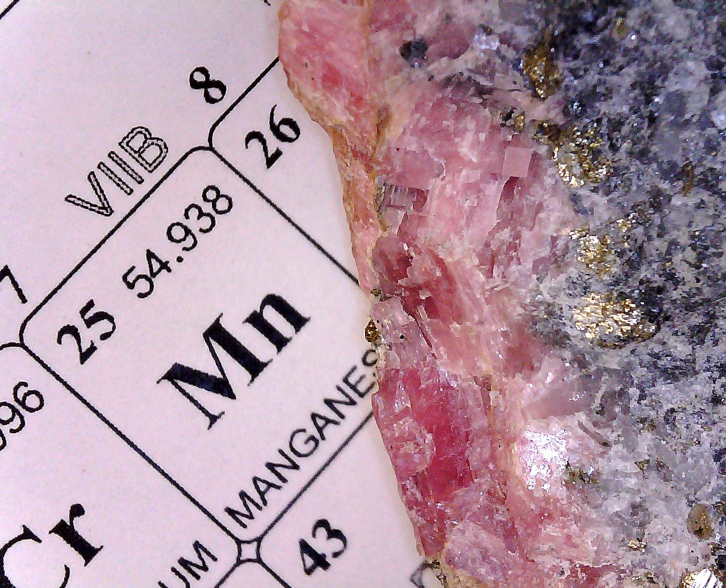
In the Pnictogen Hall of Fame there is at least one p-block compound with a town named after it. The ghost town of Stibnite, Idaho, sits silently in the Yellow Pine mining district 40 or so miles NW of Cascade, Idaho.  The town of Stibnite is named after the sulfide of antimony- Sb2S3.  The chemical symbol, Sb, is related to this mineral name.

Idaho sits in the great North American cordillera.  A cordillera is a grouping of mountain ranges at the continental scale. In the case of the North American cordillera, it begins ca 103 west longitude and extends to the Pacific ocean. The Black Hills are found somewhat east of 103 degrees, but I’m generalizing again. In the US, the Rockies, Wasatch, Cascades, and the Sierra Nevada ranges are part of the cordillera formation.

North American Tungsten Belt. From Paul F. Kerr, Tungsten Mineralization in the United States, 1946, Waverly Press.

One characteristic of the cordillera is the broad occurrence of economically important metal deposits. In the illustration above, the occurrence of tungsten is associated with the mountainous regions of the west. An important feature found in economic metal bearing districts within the cordillera are vein deposits. Metals can be disseminated in rock or concentrated in veins. 

In Colorado, the Cripple Creek & Victor mine is situated in the throat of an ancient volcano. This ore body is an example of highly disseminated gold ore which is interlaced with vein structures containing higher concentrations of gold.

Rather than perform underground mining, the economics allow the large  scale removal and crushing of rock to pebble size followed by extraction with cyanide to isolate the value.  This mining technique was not possible until the advent of large scale mechanization. In the early days, the Cripple Creek district was limited to underground mining of vein formations that were more highly enriched in gold.

What is crucial to the placement of a metal ore body is some process that leads to concentration of valuable metals. Recall that the definition of an ore is based on economic considerations.  At some level of dilution all ore becomes just gangue or country rock. Concentration of value in the ore body near the surface can arise from several mechanisms.

A common process that concentrates desirable minerals is hydrothermal deposition. This is found widely in the cordillera. A natural consequence of mountain building is the generation of stresses within the upthrusting  rock. At some point stress gets relieved by fracturing which results in the formation of void spaces within the rock.

Underground water, which at depth is at high temperature and pressure, will dissolve components of rock in contact with the water. This water will naturally convect and flow towards the surface, carrying whatever solutes that were favored by higher solubility.

Deposition occurs as the water flows to the surface within whatever fracture network the waters find themselves in and may continue to deposit until the vein seals itself shut. Over the fullness of time the formations are thrust upwards and erosion wears down the rock to expose outcroppings of the desired mineral at the surface. 

Such processes have put vein lodes in place all over the world, including the American west. Deposits of gold, silver, antimony, iron, mercury, and tungsten are examples of metals that are concentrated in this manner. Ostensibly, this is happening in geothermal hotspots like Yellowstone or Iceland today.

These exposed outcroppings weather and oxidize, generating new mineral compositions. In the case of gold, its relative inertness leads it to form the native metal in these weathered formations and, under the influence of gravity and the hydraulic forces of snowmelt, gold will work its way downhill and into the alluvium.

Other elements besides gold are also mobilized, particularly the sulfides. In the deep crust, well below the depth to which oxygenated meteoric water can flow, is an environment rich in the anionic subunits oxide, sulfide, silicate, and aluminate. Metals and metalloids like Cu, Sb, Ag, As, Pb, Hg, etc., form complexes with the various anions and correspondingly, 3 dimensional networks of inorganic polymeric species. To the extent that a 3-D network of shared atoms, edges, and faces of tetrahedral crystalline subunits can be formed, the resulting bulk material may have a high melting point and high strength.

However, when connectivity is lowered by chain or network terminating constituents, the melting temperature and hardness of the material may be lowered.  An example is soda glass. When silica is diluted with chain or network terminating components like soda or lime, the high strength and high melting point of quartz, which is just pure polysilicate, is lost. The same thing can happen naturally in mineral formation processes.

Other kinds of ore are put in place by fractional melt crystallization and layer deposition by density within a magma chamber. The major ocurrences of platinum group metal (PGM) deposits are an example of such a process. Eventually, tectonic processes raise the frozen and extinct magma chambers to the surface where erosion exposes a narrow banded horizons referred to as a reef.  The Bushveld Igneous Complex in South Africa and the Stillwater Complex in Montana are examples of this mechanism.

The deposits found near Stibnite, Idaho, are comprised of antimony and tungsten as well as lesser amounts of gold and silver. In about 1900 gold, silver, and antimony were discovered in the area, leading to a gold boom at Thunder Mountain.  During the years from 1938 to 1944, the Yellow Pine (W, Sb) and Meadow Creek (Au, Ag, Sb) mines in this part of Idaho were the largest producers of tungsten and antimony in the United States.

The details of this mining district can be found in:

John R. Cooper,  Geology of the Tungsten, Antimony, and Gold Deposits Near Stibnite, Idaho; 1951, Geological Survey Bulletin 969-F.  Stibnite Idaho USGS

In the abstract, Cooper describes the W, Sb, Au, Ag deposits as being confined to an area about 1 mile by 3.5 miles in scope (as of 1951). The principal rock of the area is quartz monzonite which is extensively fractured and has been penetrated by dikes of basalt, quartz latite porphyry, trachyte, and rhyolite.

Cooper describes a deposit whose metallization has taken place in three stages with intervening episodes of fracturing. The first stage is described as extensive replacements by gold-bearing pyrite and arsenopyrite.  The second phase of deposition or replacement is less extensive and is by scheelite (CaWO4) within the gold ore bodies.

The third stage of growth or deposition is of stibnite and silver, largely within the same fracture systems as the scheelite. The ore bodies occur with the Meadow Creek fault and associated subsidiary faults in the quartz monzonite. The tungsten-antimony ore body within the formation took the shape of a

“flat upright funnel flaring to its widest diameter at the surface and tapering to a narrow neck, which extends below the bottom of the minable tungsten ore. The underside of the ore body is very irregular in detail.  The highest grade of tungsten ore was concentrated toward the center of the mass and was surrounded by an envelope of antimony ore containing only a little tungsten.”    – John R. Cooper

The Meadow Creek ore contained 0.23 oz gold per ton and 1.6 percent of antimony.  The Yellow Pine ore contained little gold but 4 percent of antimony and 2 percent of WO3. The Yellow Pine deposit was exhausted of tungsten in 1945, producing 831,829 units of WO3 equivalents in the concentrate. One unit of WO3 is 20 lbs of tungsten trioxide.

Much of the scheelite was found disseminated in brecciated gold ore.  Some scheelite was found in branching stringers and veinlets within the groundmass.

The stibnite occured as “disseminations, microveinlets, stockworks, massive lenses, small fssure-filling quartz stibnite veins, and euhedral crystals coating late fractures. ”  Oxidized antimony minerals such as kermesite (Sb2S2O) were reported as being very scarce.

Extractive metallurgy of the 19th century

The first gold lode discovered in Colorado was found where the town of Gold Hill, Colorado, now sits. Gold Hill is presently at the locus of the Four-Mile Canyon fire west of Boulder. As of  today, more than 170 structures have burned, including a few outhouses.

Today, a single gold mining operation remains active at Gold Hill. The kid and I recently visited the area and I wrote a post about Wall Street, south of Gold Hill.

In the last few years I have been fascinated by what started as a simple question-  How did they get the gold out of the ore in the 19th century?  What has become apparent to me as a chemist is the extent to which reasonably sophisticated multistep extraction schemes were employed by 19th century mills and smelters. Their methods of processing would not be unfamiliar to alchemists who practiced similar arts over 400 years earlier.

The alchemists had techniques of calcination, comminution, lixiviation, and distillation available to them. In using these processes, they were inadvertantly performing reduction and oxidation reactions so as to alter the composition of substances with the hope of improving the prospects for isolation of desirable metals.  The 19th century gold and silver mill operators inherited these techniques and mechanized them. One of the key improvements over their medieval predecessors was that they had reasonably sensitive analytical methods as well as some scientific knowledge of the chemical behavior of materials- we call it chemistry today. As the 19th century American gold rush went forward, there became available new methods of gold and silver extraction involving mercury, chlorine, cyanide, and sodium or potassium sulfide and thiosufate.

Any 21st century chemist will recognize most of the inorganic chemistry of 19th century milling and smelting of metals.  But in those days it was not referred to as chemistry- it was known then as it is today as Extractive Metallurgy.

Much of the technology for extractive metallurgy traces back through European mining engineers who had come to the American gold and silver districts.  Two mining engineers in particular stand out in 19th century Au/Ag metallurgy- Guido Kustel and Philip Argall. More about these fellows at a later date. Suffice it to say that they were prolific problem solvers in a time when mine and mill operators typically had more investor’s money than sense.

Some Milling and Smelting Business Models

Prospectors working alone or with investors backing them would prospect a promising area of ground for gold or silver, looking especially for vein outcroppings. If they has cause for optimism they would file one or more claims for the right to have access to the minerals therein. A patented claim was a claim issued by the federal government as a deed that could be bought or old like a a parcel of land. Most of the land of interest was state or territorial land. Many times a claim was filed based on speculation, and a nearby claim with a vein that might go in the right direction would potentially be valuable.

The miners would begin to develop the claim by digging an adit and drifting horizontally following a vein system, or they might dig a shaft in a promising spot in hopes of intercepting a vein rich in value.  Since they were focused on veins which were visible to the miners, the miners were able to dig along the direction of the vein. In doing so, they could hand sort unproductive rock into a waste pile and collect concentrated ore separately.  But then what?

Some mine operators were wealthy enough to have their own mill or smelter to extract the value. However, the majority of mines would sell their ore to a mill, which might be many miles away. A price based on an assay could be negotiated, and the ore sold outright to the mill. The mill would make its profits by selling the gold or silver it extracted. Sometimes a mine would pay the mill a tolling charge and keep ownership of the gold or silver.

Milling and smelting could be a lucrative business or it could result in a total loss. Mills and smelters were run by companies who had plowed a significant financial investment into+ the operation. They relied on the productivity of the gold or silver district. Not infrequently multiple mills or smelters would appear in a district affording lots of competition for ore.   Milling and smelting was labor and energy intensive. Old photographs often show the mills sitting in a mountainous area clear-cut of trees. Wood was needed for buildings and firewood. Refining operations required many cords of wood to run the furnaces or to generate steam for the stamp mills.  If a mill ran out of fuel, their operations were threatened.

Many mines produced ore that was sold to the mill. Mine operators might be paid for the assayed value per ton of ore delivered, or they might be paid a fraction of what was extracted by the mill. The mill could be just down the hill from the adit or shaft, or it might be many miles away.  As a rule, transportation costs were quite high.  Some districts like Caribou had teamsters who would haul ore by horse drawn wagons to mills some distance away. Other districts had rail transportation.

Naturally, ore samples could be tampered with by miners interested in increasing the apparent value of their ore. Sampling methods were developed to produce representative samples for assay. Mills had assay offices to test for the value in the ore and to measure the fineness of their bullion.  Cuppelation was a standard method of providing a gravimetric determination of the gold content of ore.  More on cuppelation in a later post.

Field Trip Report. Finding Faults.

Th’ Gaussling, traveling with a 3-van convoy of local geologists, participated in a field trip on May 22, 2010. The purpose of the trip was to get an appreciation of the kinds of faults to be found in and around the IRSZ and get some insight into the phenomena of faulting. The trip was organized by the Colorado Scientific Society, an earth science oriented organization. This was my second field trip with CSS.

GPS coordinates and elevations were acquired with a Garmin eTrex handheld receiver. Waypoints (WP’s) are just the latitude and longitude of physical locations of interest.  Elevations generally aren’t required to find the formations, but are provided as a matter of general interest.  The photographs are my own and if copied, I would appreciate a citation and/or link.

The trip leader was Jonathan S. Caine, a USGS research geologist who has done more than a bit of work relating fault and fracture networks and fluid flow in the earths crust. A feature called the Idaho Springs-Ralston Shear Zone (IRSZ) was part of the topic of this trip. As Caine says in the abstract on the previous link, the IRSZ is thought to be a persistant weakness in the continental crust. There is interest in the relationship between the IRSZ and the Colorado Mineral Belt. 

Geologists discuss Junction Ranch fault (WP003)

  WP003-  N 39° 44.700′, W 105° 17.485′ elevation 6266′. 

Closeup of Junction Ranch fault. Note white calcite vein (WP003).

 The Junction Ranch fault which had an exposure at waypoint 003 was an example of a fault in a formation that has seen considerable hydrothermal alteration. The orange iron stains on the rock are a clue that fluid transport of minerals has taken place. Calcite veins within the foliated clay filling the fault are an indication that the clay was deposited first. There is no evidence, however, that the fault predates the hydrothermal alteration. 

In a roadcut along the Central City Parkway is an exposure of a brittle fault at location WP005-  N 39° 44.990′, W 105° 28.233′, elevation 7571′. 

Roadcut exposing a brittle fault along Central City Parkway (WP005).

 The formation exposed at WP005 was part of a very old structure with multiple faults and igneous intrusions. In the photo above, the edge of the fault is enhanced with a black line drawn in during editing. The surface above the black line is an example of a slickenside, or one surface of the fault. Some members of the trip said they could see slickenlines, but they are so subtle that it is hard to be certain. A large igneous intrusion 100 m away showed signs of dislocation, presumably due to a fault. Boudins were observed at this location and are shown in the photo below. 

Central City Parkway road cut, boudins visible in foliated rock (WP005).

We visited the location of a fault in Coal Creek Canyon. This is a NNW trending distributed deformation zone which is part of the Boulder Batholith. This location is designated WP008- N 39° 54.268′, N 105° 20.795′, elevation 7771′.  

This fault was discovered filled with clay and dips 35 to 45 degrees. It was further exposed by excavation by Caine and another geologist. Again, the approximate boundary of the fault was enhanced with black lines in editing. There was considerable alteration of the rock on the hanging face side of the fault with iron staining associated with hydrothermal alteration.

Coal Creek fault at WP008 May 22, 2010.

We visited a ductile shear zone with suspected mylonite features. It was located at WP007- N 39° 51.026′, N 105° 21.155′, elevation 7634.  Mylonite zones are evidence of ductile shear in response to a stress field.  Near the mylonite zone was a fault with exposed slickensides. While faulting and ductile deformation may seem incompatible, it should be remembered that over time many kinds of phenomena can be overprinted on the rock formations. Rock may deform in a ductile manner and sometime later undergo brittle fracture.

Suspected myolinite feature (WP007).

 The field trip leader was very enthusiastic and because of his background, was able to provide many important insights into the local geology. It was a very worthwhile day in the mountains.

Cripple Creek and Victor Gold Mine Tour

A vanload of members of the ACS, Colorado Section, were treated to an extensive tour of the Cripple Creek and Victor (CC&V) mine last Friday. The photo below shows a view of the mine from the abandoned American Eagle Mine above the CC&V pit operations. The mountains in the background are the Sangre de Cristo range.

View of Cripple Creek & Victor Mining Operations from the American Eagle Mine, May 2010.

A haul truck bed was converted to a scenic overlook platform (below).  A few section members take in the view.

CC&V Scenic overlook platform

From this high vantage point we could see blasting operations at work. Multiple sites may be prepared simultaneously. Blasting typically occurs at 1:00 pm. Holes are drilled on 20 ft centers for optimum coverage. Every blasting hole is sampled and analyzed by ICP to measure the gold value for that zone.  Zones with low value are hauled to the waste heap and the high value rock is taken to the crusher.

Preparation for blasting, CC&V, May 2010.

We visited the pit and watched haul trucks get loaded by a gigantic loader. For every one truckload of ore there are two truckloads of unproductive rock that have to be hauled to a separate location on site. The definition of unproductive rock depends entirely on the market price of gold.  In the photo below, drilling rigs for the blasting charges are in operation for the next round of blasting.

Loading area, CC&V Mine.

Later we watched the trucks unload into a crusher with a gyrating element that crushed the rock into football sized chunks. The resulting rock is conveyed to a screener and another crusher in order to further reduce the size to 0.75 inches. Every truckload of rock is treated with lime to help maintain a high pH for the aqueous cyanide leaching operation.  In the photo below, the white tank on the lower right contains the lime.

Heap leaching operations, CC&V May 2010.

The gold bearing rock is irrigated with a very dilute sodium cyanide solution which percolates to the bottom of the heap and is captured in a basin feature at the bottom of the heap. The “pregnant” solution of gold cyanide extract is pumped out from under the heap at 14,500 gal/min into a cascading series of charcoal filtration tanks in the extraction building (see photo).

Pregnant solution passing over charcoal filter bed. CC&V May 2010.

Once a specified loading of Au is sorbed onto the charcoal, the sorbent is treated with hot concentrated cyanide. This concentrate is then passed over steel wool where the gold precipitates. The precipitated gold is then smelted to produce bulk crude metal which is shipped off-site for further refinement.

Chemistry Field Trip!

So I decided to kick up my interest in the local metalliferous deposits and get more folks involved. As a member of the executive cmte of the ACS local section I’ve organized a seminar at a local university and arranged to have the lead exploration geologist from CC&V come to talk about the their gold mine in Cripple Creek.

The seminar is thursday night. Friday morning a few of us will board a van and drive the 5 h round trip to visit the open pit operation. We’ll stop at the nearby Molly Kathleen mine as well. I’m hoping we’ll be 1000 ft down the hole when the mine next door begins blasting. That’s an unforgettable experience.

Enthusiasm is contagious.  Especially with regard to gold colored precious metals. Unfortunately, bench chemists have few opportunities to take field trips. So the thinking here is that we’ll find a way to get members out and about to look at heavy industry. And gold mining is definitely a chemically related industry. Email blast notifications to rouse attendance are surprisingly ineffective- 1 or 2 % response at most. It is hard to get folks to participate in local section activities because everyone has a life.

The next day I’ll be on a field trip with geologists to visit various sites showing ductile and brittle deformation as well as hydrothermal alteration of formations in the central front range. I’ll be a chemical science interloper, as usual. The key to many of the metalliferous features in the world is hydrothermal transport. Shallow magma intrusions energize a kind of heat engine that pumps water through metal-bearing rock and transports hot, pressurized mineral laden fluids through a large and cooler network of fissures and faults where minerals precipitate according to their solubility.  Hydrothermal alteration is an important feature to look for when prospecting for metals.

Eyjafjallajökull Volcano

A few decent links-

It has been estimated that the magma source for the Eyjafjallajökull Volcano is greater than 20 km below the surface. 

A great source of information is the Icelandic Met Office. This organization issues daily reports on the status of the volcano.

A local Icelandic company providing  webcam coverage of the volcano is Miles Telecommunications.

Eyjafjallajökull Volcano (Nasa Photo)

The worlds most unpronounceable volcano, Eyjafjallajökull, located under a glacier on the south central edge of Iceland, continues to erupt with fountains of lava and prodigous volumes of dispersed ash clouds.  The NASA image above shows the lava fountains and steam emanating from the volcano. Others have captured excellent photos as well. 

“The Geology and Geodynamics of Iceland” is the title of a paper by Professor Reidar G. Tronnes, presently at the Natural History Museum at the University of Oslo. The Tronnes paper gives an excellent overview of the tectonic circumstances of Iceland and outlines some of the latest thinking on the basis of Icelands seismic and volcanic activity. 

The Icelandic landmass is the result of some very productive vulcanism stemming from a buoyant plume of magma that drives the vulcanism of Iceland. Figure 1 of the Tronnes paper shows the extensive subsurface ridge system extending from Greenland to Scotland. Figure 3 shows how the line of divergence sits in place while spreading of the sea floor and the Iceland plateau occurs on either side of the rift system. The rifting produces swarms of fissures which are coincident with the siting of the volcanos. The Mid-Atlantic ridge cuts across Iceland and assures that this location is a center of seismic and volcanic actitity.

Eruption of Eyjafjallajökull Volcano, Iceland (Photo Credit: Nasa Earth Observatory)

 NASA Earth Observatory link.

Gravity Anomaly Along the Colorado Mineral Belt

The Colorado mineral belt (CMB) is a swath of metalliferous mineral veins and faults spanning 15 to 30 miles in width and running ~250 miles in length between Dolores and Jamestown, Colorado. This NE trending zone encloses most, but not all, of the significant occurrences of gold and silver deposits found to date in Colorado.

Significant finds like the Cripple Creek district have been found outside the CMB, but these are exceptions to the trend. The large gold/silver/tellurium lode in the Cripple Creek diatreme is the result of a volcanic past that stands somewhat apart from the vein deposition processes that produced the CMB lodes.

What is especially intriguing about the CMB is that it is coincident with a significant gravity anomaly. It turns out that a particularly deep negative gravity anomaly exists in the Colorado Rocky Mountains. A few papers on this effect can be found on the web. In particular, a paper (ref 1) by Mousumi Roy at the University of New Mexico offers some details on the  extent of the gravity anomaly and some possible reasons for the effect.

At first blush it might seem odd that a negative gravity anomaly should coincide with a region known for heavy metal deposits. After all, dense matter has greater mass per unit volume, and if there is a lot of volume, then one might expect the acceleration of gravity to be a tiny bit greater than some reference value.

While this line of reasoning has merit, it turns out that despite the presence of thin metalliferous veins in the region, the overall density of rock below the CMB formation is somewhat low. A density contrast exists in the CMB formation and the surrounding rock. A large, low density formation in the crust and/or upper mantle would cause the local acceleration of gravity to be slightly below that of the reference geoid value.  The structure of the density contrast is the subject of some scrutiny and has been addressed by Roy and others.

A large low density mass below the surface is expected to have some buoyancy. A buoyant mass is one that would exert an upward distortion on the crust. The Colorado Rocky Mountains are part of a region characterized by numerous past episodes of mountain building. Whether mountain building was the result of large scale tectonic interactions or more localized effects of density contrasts, the fact remains that a gravity anomaly exists coincident with the CMB.

The mechanical effect of the upthrust of the lower members of the crust to form the Colorado Rocky Mountains has been that a series of faults and fractures have formed. These void spaces have provided networks for the flow of mineral rich hydrothermal fluids over geological time.

High pressure, high temperature aqueous fluids are prone to cooling and depressuriation as they work their way upwards into cooler and less constricted formations. At some point these fluids throw down their solutes and suspensions in the form of solids that occupy the void network. Eventually the flows become self-sealing and circulation halts leaving veins filled with chemical species that were selectively extracted and transported from other formations.

The earths hydrothermal fluid system is continuously extracting soluble components and transporting them to distant locations where solubility properties force their deposition. But this process does not always produce solid, compacted veins. Void spaces can be left behind at all scales, from microscopic size to large chambers. These spaces are called “vugs”. Rock with a large fraction of void spaces is referred to as “vuggy”. It is possible to walk up to a mine dump in the CMB and find hand samples of vuggy rock. It is not unusual to find crystals of pyrite or other minerals lining the internal spaces of the vugs.

1.  McCoy, A., Roy, M., L. Trevino and R. Keller, Gravity models of the Colorado Mineral Belt, in The Rocky Mountain Region – An Evolving Lithosphere: Tectonics, Geochemistry, and Geophysics: American Geophysical Union Geophysical Monograph 154 (eds. Karlstrom, K.E. and Keller, G.R.), 2005.

[Note to the reader: Th’ Gaussling is just a chemist, not a geophysicist. But like many others, I have the ability to read and learn. When I learn something new and interesting, I like to write about it. It reinforces the learning.]

Mercury Mining

One of the least appreciated aspects of the 19th Century gold mining boom in North America was the necessary and parallel boom in quicksilver, or mercury. Numerous mercury bearing minerals are known, but by far the bulk of historical mercury production has come from cinnabar, or HgS. For clarity, cinnabar is distinct from vermillion which is a pigment derived from cinnabar. 

Recovery of gold can be performed by methods as simple as plucking nuggets from a pan or by gravity separation in the form of sluicing. Unfortunately, in many areas placer gold is quickly exhausted by eager miners. Where there is placer gold there is often a lode formation to be found. Gold in a lode can be much more problematic in its recovery.  

Gold from a lode may be found comingled with quartz in bulk form, partitioned in a vein, or dispersed at high dilution in a host rock at a large scale. Lode gold very often has to be extracted from a problematic matrix. In this circumstance, chemical means are necessary to extract and concentrate the value from the rock.

A chemical solution to gold isolation is limited to only a few economically viable possibilities. Beyond macroscopic placer gold there is amalgamation with mercury, borax, cyanidation with NaCN, and chlorination with Cl2 or NaClO. 

Amalgamation has been attractive historically because of its great simplicity. First, cinnabar is readily coerced to liberate mercury by simple roasting and condensation. Dispersed gold is contacted with mercury and selectively extracted. The resulting solution of Au-Hg is relatively easy to isolate by natural phase separation. Finally, gold is easily recovered from the amalgam by heating in a retort. Chemists would call this a simple distillation.

Some silver will also be amalgamated, but it is separated by roasting to silver oxide followed by amalgamation of the residuals. Unfortunately, gold tellurides are problematic for direct gold amalgamation. Gold tellurides must be roasted first to liberate volatile tellurium oxides and native gold residues. Energy becomes a major cost driver at this stage.

Cinnabar ore (Image from Mineral Information Institute)

US cinnabar ore deposits are found predominantly  in California and to a lesser extent in Nevada, Oregon, Arizona, Texas, and Arkansas. The geology of cinnabar ore bodies share a few general features. Cinnabar ore is found in zones historically associated with volcanic activity and alkaline hydrothermal flows.  Ascending flows of metal sulfide saturated water infiltrated faults and fractures and deposited HgS rich mineral.  This is a common ore forming mechanism and is responsible for diverse metalliferous deposits, including mercury. 

Figure 1. Franciscan Quicksilver Ore Body Structure (C.N. Schuette, The Geology of Quicksilver Ore Deposits, Report XXXIII of the State Mineralogist, January 1937.)

According to Schuette, a common feature to economically viable cinnabar occurrences was the presence of a cap rock formation over the ore body. The infiltration of cinnabar laden hydrothermal fluids into fissures and shrinkage cracks in basalt intrusions as well as deposition in brecciated rock in the fault zones lead to enrichment of the mineral.  An impermeable layer above caused a pooling accumulation of mineral and a barrier to oxidation. 

Figure 2. Diagram of Sulphur Bank Mine (C.N. Schuette, The Geology of Quicksilver Ore Deposits, Report XXXIII, of the State Mineralogist, January 1937.)

In these California formations cinnabar is regarded as a primary mineral, meaning that it is the direct result of transfer from deeper source rock. An example of secondary rock would be serpentine (Fig 1) which is formed as a result of aqueous alteration of another mineral. Serpentine is a group of minerals comprised of hydrated silicate which may contain some combination of  Mg, Fe, Al, Mn, Ni, Ca, Li, or Zn. According to Schuette, serpentine is often found associated with cinnabar formations. 

The Sulphur Bank Mine near Clearlake Oaks in Northern California offers an interesting example of cinnabar mineralization. Figure 2 shows a fault that provided a channel for fluid flow to upper level rock formations. Over time oxygen and water caused the oxidation of sulfur to sulfuric acid which aided the decomposition of cinnabar and the host rock. 

Note that the uppermost layer is said to be white silica which resulted from extensive demineralization of solubles from a silicate matrix. Further down, native sulfur was discovered in more reducing conditions and was actually recovered in early mining operations. Cinnabar was located below the layers of oxidized mineral. 

This phenomenon of surface oxidation of an exposed ore body is observed in gold and silver mines as well. Miners often lamented that the nature of the lode changed as the mine operations got deeper. Of course, what was happening was that oxidized formations are encountered near the surface and as the mine gets deeper, progressively greater reducing conditions are found with a corresponding change in mineral species present. 

Air oxidation or infiltration of meteoric water with dissolved air and CO2 would cause the alteration of sulfide minerals to more water soluble H2S and sulfates, leaving native gold behind. But at greater depths, the composition of the ore changes to afford heavier sulfide loading and therefore a requirement for a different kind of milling. 

As it happens, the recovery of mercury from cinnabar is quite simple and has been done since Roman times. Typically, the ore was crushed and roasted in the combustion gases of a reverberatory furnace. This kind of furnace was constructed to isolate the fuel from the ore by a partition and rebound or reflect the hot gases off the ceiling of the furnace onto a heap of ore. Despite the name there is no acoustic aspect to the process. 

The hot gases would produce HgO and sulfides which would oxidize in the gas stream to volatile sulfur oxides. Thermal decomposition of HgO at ca 500 C produced mercury which was condensed out of the exhaust gas stream and collected as the liquid. 

Pitchblende in the Wood Vein, Central City District

Recently I came upon a copy of Geological Survey Circular 186, 1952, F.B. Moore and C.R. Butler, Pitchblende Deposits at the Wood and Calhoun Mines, Central City Mining District, Gilpin County, Colorado. Like many Geological Survey documents, it contains a pocket with neatly folded scale drawings of the mine workings. These drawings chart the location and elevation of the shafts and drifts and give a best estimate as to the extent of the formation.

Vein Structure in the Central City District. (From Geologic Survey Circular 186, 1952.)

What is interesting about the map above is not so much the minute detail of the locations, but rather the obvious trend of the veins (solid lines with dots).  They are all east-northeast trending.  The country rock is largely precambrian granite gneiss and quartz biotite schist according to the survey. It doesn’t take long to figure out that the mine locations correlate with the veins.

Geological Survey maps of 3 levels of the Wood Mine, Gilpin County, Colorado (Geological Survey Circular 186, 1952).

The second figure was generated by Moore and Butler in 1950 and shows the locations of pitchblende occurrences in three levels of the Wood Mine near Central City, Colorado. The red dots indicate the location of pitchblende along the three drifts at the 135, 197, and 275 foot levels of the mine.

Profile of the Wood Mine, Central City District, Illustration from Geological Survey Professional Paper 371, 1963.

 The Wood Mine was an early and prolific source of pitchblende, though presumably it began as a gold /silver operation. The workings reportedly reached a depth of 600 ft.  The Wood vein is in a fault fissure that shows extensive alteration from hydrothermal action. The width of the vein varies with the type of country rock in which it is found, but ranges from from 1 to 18 inches and has been followed for a lateral distance of nearly 1000 ft.

The productivity of uranium mines is commonly expressed in terms of equivalent weight of U3O8 rather than weight of ore, given the large variety of mineral forms uranium is found to occur in. The figure above is from Geological Survey Professional Paper 371, P.K. Sims and collaborators, Geology of Uranium and associated Ore Deposits, Central Part of the Front Range Mineral Belt, Colorado. Extensive stoping has been done in an attempt to vertically intercept the vein. This was a common practice in hard rock mining- let gravity bring the muck to you.

Pitchblende was discovered on the dump of the old Wood shaft in 1871. Circular 186 reports that by the end of 1872, 6,200 lbs of ore containing 3,720 lbs of U3O8 had been removed. By 1916, 102,600 lbs of ore bearing 30,040 lbs of U3O8 equivalent had been recovered.  The high grade pitchblende was hand sorted and that below ca 10 % was discarded or lost in gold and silver processing.

In Circular 371, Sims observes that “Pitchblende occurs as small, discontinuous lenses and streaks on the footwall of the Wood Vein, which are separated by nonuraniferous vein material.”

What is intriguing is that pitchblende was apparently an item of commerce in the early 1870’s. Radium, extracted from pitchblende, was not discovered until 1898 by the Curies.  A procedure for the preparation of sodium diuranate, Na2U2O7 6H2O, was reported as early as 1849 (Patera, J. pr Chem. 1849, [i] 46, 182. Early uses of uranium yellow were in paints and stains for glass and porcelain. This pigment has also been used for the production of fluorescent uranium glass.

Uranium roll fronts

As a kind of hobby Th’ Gaussling has been surveying the literature on uranium occurrences in North America. Uranium is found in many interesting locations and as a result of several distinct kinds of ore forming processes.

Prospector with Geiger Counter

From Ballard &Conklin, Uranium Prospectors Guide, 1955 Harper & Brothers

For the most part, uranium ore body formation is the result of aqueous transport and deposition.  Uranium is found as a lode in vein formations in precambrian  igneous/metamorphic structures as in the case of the Schwartzwalder mine near Denver. In fact, there are many lode occurrences that contain a variety of uranium minerals in the Colorado mineral belt.

What seemed counterintuitive to me was the extent to which uranium is found in sandstone. Evidently I had developed a bias for connecting heavy metal occurrences with igneous/metamorphic formations.

Uranium occurrences in sandstone take on certain characteristics as a result of ore forming processes. Uranium is often found in concentrated bodies called “roll fronts” or “ore rolls”. A roll front is a body of concentrated mineral with a lenticular cross section and is found in confined strata sandwiched between impermeable clays, shales, or mudstones.

Roll Front Cross Section

Adler & Sharp, Guidebook to the Geology of Utah, No. 21, Utah Geological Society, 1967, p. 59.

The action of oxygenated meteoric water (i.e., rain and surface water) migrating through a porous sandstone stratum will selectively mobilize mineral species that are soluble. In the case of uranium, the relatively insoluble U4+ compounds are oxidized to more soluble U6+ species which are then mobilized and flow in the formation.

Eventually, as the water flow encounters reducing conditions, U6+ gets reduced to U4+ and deposition occurs. Sandstone with organic material may be a net reducing environment and provide the necessary carbonaceous reductants to do the deed.

As the U6+ enriched aqueous flows encounter reducing conditions, deposition of U4+ insolubles occurs in a manner determined by fluid mechanical forces. The result is an elongated and tapered ore body confined to a narrow stratum.

Uranium roll fronts are common in many uranium districts. The Uravan uranium belt in the Colorado Plateau is a good example. Uranium is found concentrated in tuffaceous formations as well. An example of this is the uranium occurrence found in the 39 Mile Volcanic Field in the central Colorado mountains.

What is interesting to ponder is the geological effect of plant metabolic byproducts like oxygen. Oxygen directly contributes to a natural process that lead to the concentration of a scarce element like uranium. Plant life facilitating nuclear power. Hmmm.